From its groundbreaking on Nov 17, 1962 to dedication ceremonies May 21, 1966, nearly 1,000,000 hours of labor, planning, testing, and finishing went into the project. At the time of construction, the Barrier protected some 30+ industries employing more than 10,000 people. The goal was to provide future flood security for these industries, the fishing fleet vital to this area, and hundreds of coastal homes.
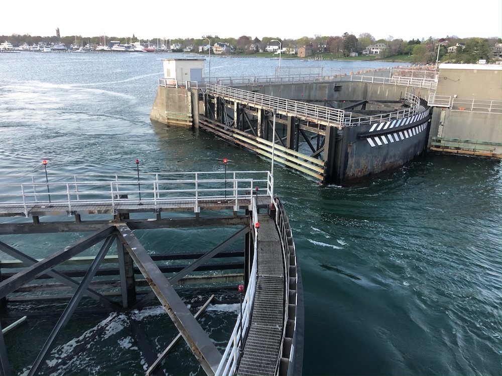
Views of the Harbor Gates open for marine traffic.
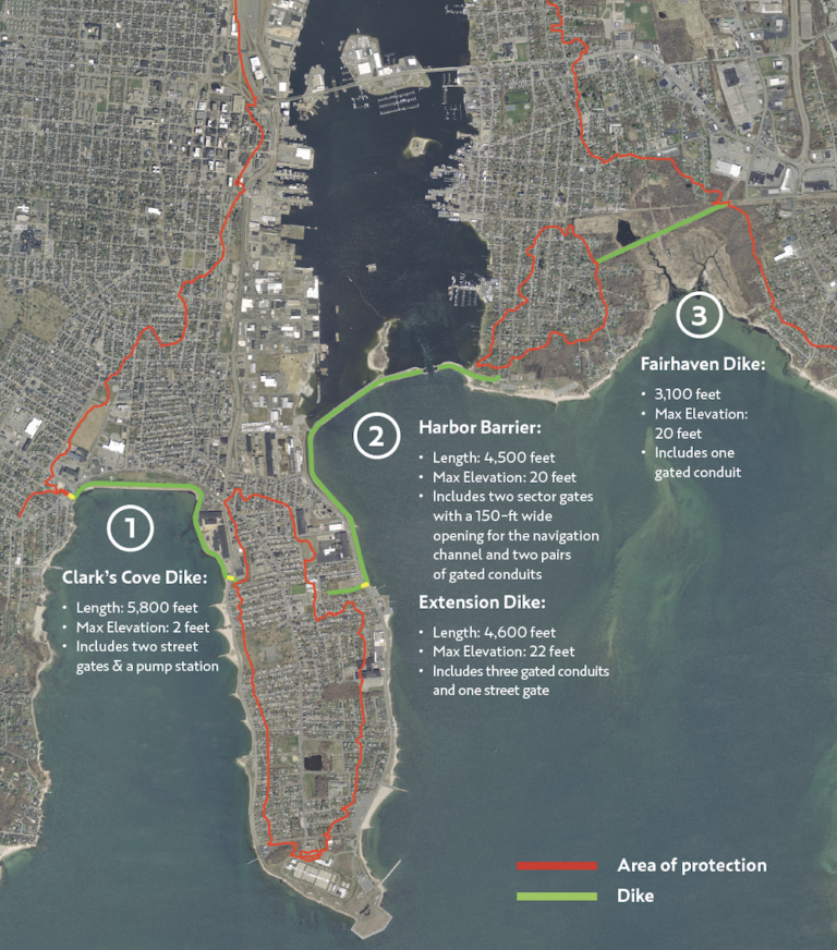
Protection from Surging Waters
The barrier consists of three principle features:
1. Clark’s Cove Dike
2. Harbor Barrier and Extension Dike
3. Fairhaven Dike
Collaborative Operations
The city of New Bedford maintains and operates the majority of the project with two exceptions.; the sector gates across the navigation channel and the harbor barrier are operated and maintained by the U.S. Army Corps of Engineers, and the Town of Fairhaven maintains the Fairhaven Dike.
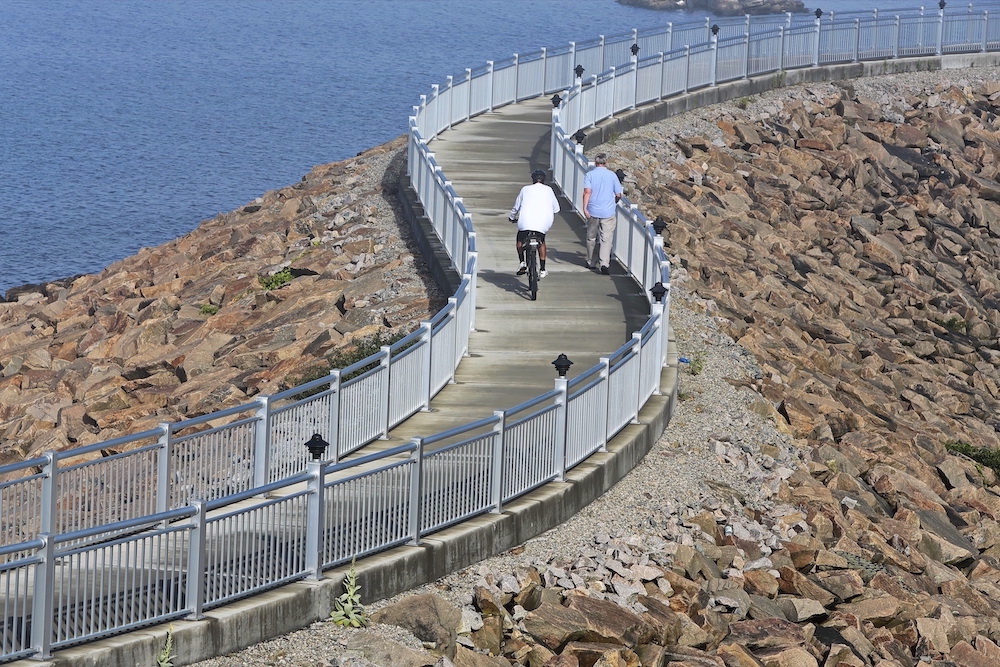
Today, the top of the barrier provides a walkway for recreational activities. Opened in 2015, the New Bedford Harbor Walk is 3,880 feet long. Connecting with a bike path running along the waterfront into historic Fort Taber Park, the path gives visitors an expansive view of Buzzard Bay.
In 2017, a 5,550-foot CoveWalk opened atop the hurricane barrier on the western side of the peninsula, overlooking Clark’s Cove. Currently, plans for a new RiverWalk are underway; the 17,000-foot recreational waterfront path will be developed on the upper harbor, along the western bank of the Acushnet River north of the New Bedford-Fairhaven Bridge.
Photo by Peter Pereira
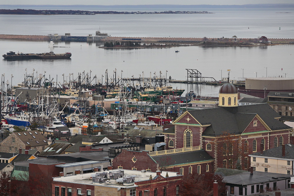
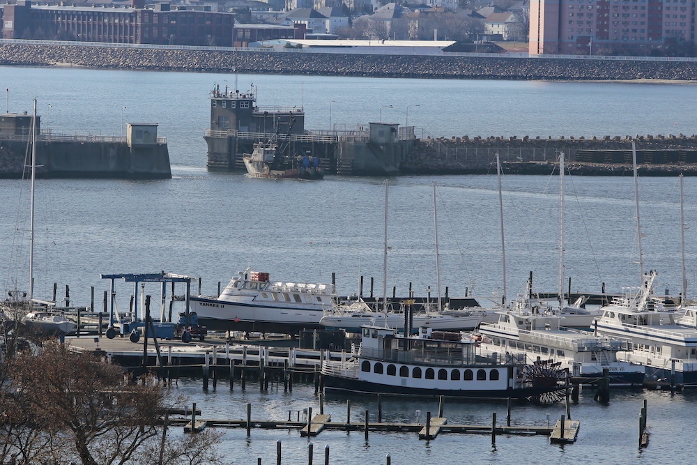
Closing the Gates
The hurricane barrier has prevented over $37.9 million in flood damages since its construction. Although the gates close up to a dozen times a year for storm events that bring tidal surges, a closure for a hurricane is rare.
Photo by Peter Pereira
1991
Hurricane Bob
Met the criteria for closures as the Category 2 storm, causing over $1.5 Billion in damages in Southern New England. New Bedford’s inner harbor was protected by the dike from a storm surge of 7.6 feet.
2012
Hurricane Sandy
Engineers estimate that $3,625,000 in flood damage to the city of New Bedford was prevented during the hurricane from operation of the hurricane barrier. The peak total height of water was 6.8 feet (2.4 feet predicted tide plus 4.4 feet storm surge).
2021
Hurricane Henri
The last time the hurricane barrier was closed was in August 2021 as the SouthCoast braced for Hurricane Henri. Although the storm missed New Bedford, the closing helped prevent inland flooding from storm surges and $94,000 in damages; a high number for a storm only 0.1 foot over closure criteria.
“The Hurricane Barrier located here in New Bedford Harbor, designed and built by the US Army Corps of Engineers in 1962, is the largest and most sophisticated barrier in the world. Since its construction, it has yet to be given the ultimate test.”
— Robert Rousseau, Manager of Hurricane Barrier Quoted in ‘A Wind to Shake the World – The Story of The 1938 Hurricane,’ by Everett S. Allen; dir. by M.L. Baron, 1976.
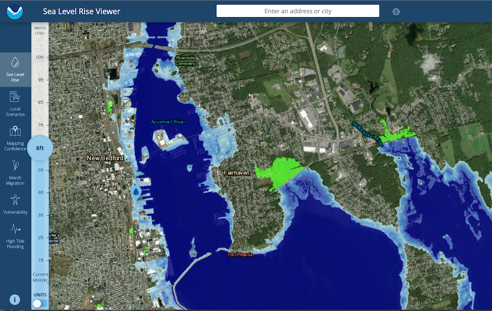
Given the ever-changing port economy, rising sea levels, and more frequent storms, it’s important to evaluate the potential impact of climate change our local landscape.
Survey sea level rise and potential coastal flooding impact areas.
Compare inundation levels to local relative sea level rise scenarios
Survey potential changes in march and other land cover types
View potential impact of coastal flooding on a vulnerable population
Explore areas susceptible to high tide flooding and historical flood events
The National Oceanic and Atmospheric Administration (NOAA) National Hurricane Center, in partnership with the U.S. Army Corps of Engineers (USACE), uses the Sea, Lake, and Overland Surges from Hurricanes (SLOSH) model to calculate the storm surge heights and map coastal areas with the highest degree of exposure. Visit coast.noaa.gov to learn more.